

GPSMAP® H1i Plus


GPSMAP® H1i Plus
Overview
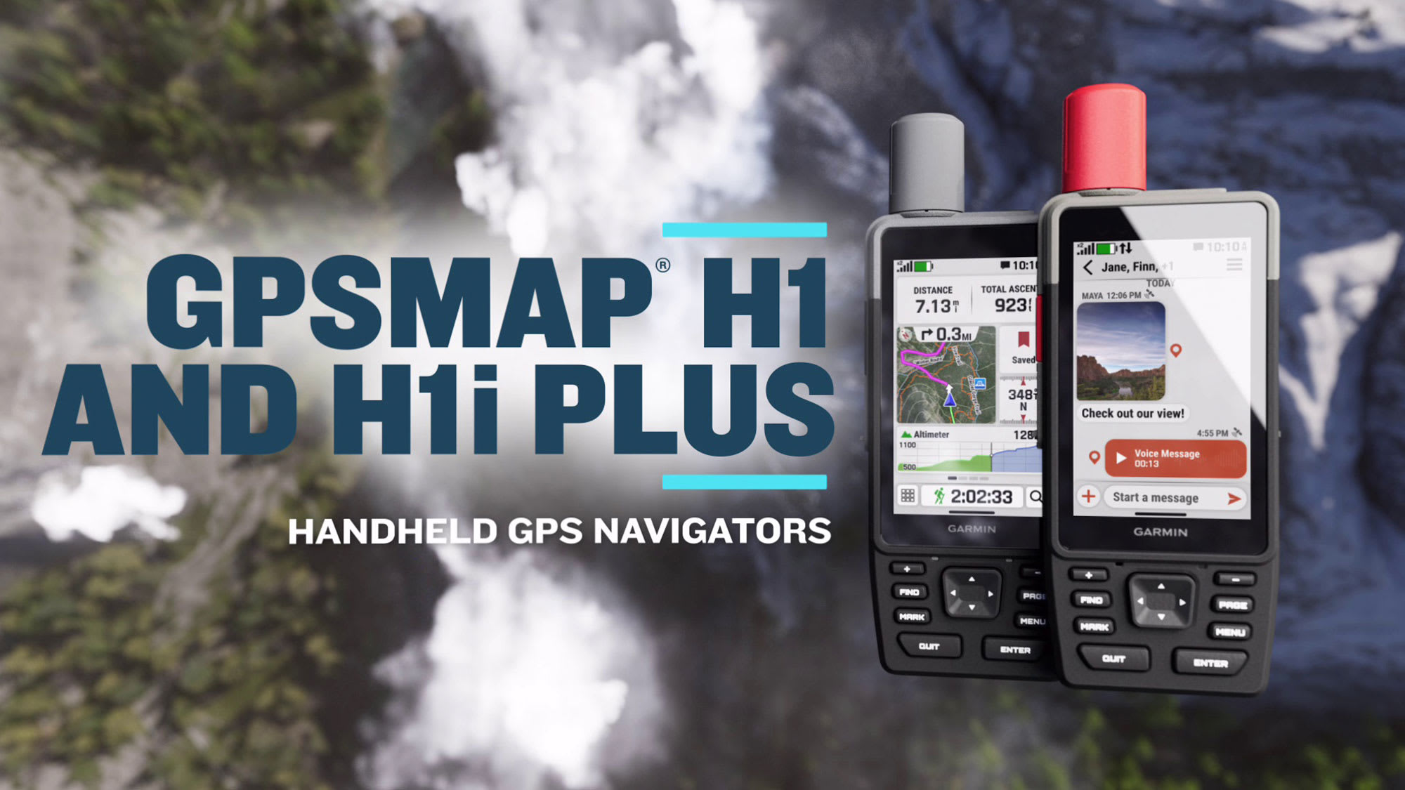
WHEN ADVENTURE CALLS, RESPOND
This rugged GPS handheld navigator has a modern design, preloaded maps and built-in inReach® Plus technology1 to stay in touch beyond cellular coverage. It's time to hit the trails.
HYBRID DESIGN OFFERS A 3.5-INCH COLOR TOUCHSCREEN AND PHYSICAL BUTTONS
EXCHANGE PHOTOS, VOICE MESSAGES AND TEXT MESSAGES WITH AN INREACH SUBSCRIPTION1
SEND AN SOS MESSAGE TO THE GARMIN RESPONSE℠ CENTER FOR HELP IN AN EMERGENCY (SUBSCRIPTION REQUIRED)
PRELOADED TOPOACTIVE MAPS, DOWNLOADABLE SATELLITE IMAGERY AND OPTIONAL OUTDOOR MAPS+ CONTENT
LONG BATTERY LIFE OFFERS UP TO 145 HOURS IN GPS MODE
MULTI-BAND GPS AND MULTI-GNSS SUPPORT HELPS PINPOINT YOUR PRECISE LOCATION
WHAT YOU'LL LOVE
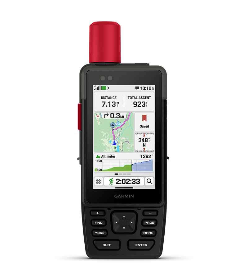
TOUCHSCREEN DISPLAY
The bright, sunlight-readable 3.5-inch color touchscreen has chemically strengthened glass to resist scratches. It is glove-friendly, easy to see and easy to use. Tap, zoom and swipe on the maps to follow your route.
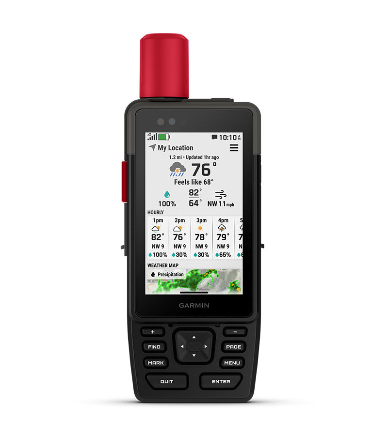
PHYSICAL BUTTONS
The rugged hybrid design also features intuitive push buttons for more versatility when in weather and while wearing gloves. The quick-action button lets users customize functions to their specific needs.
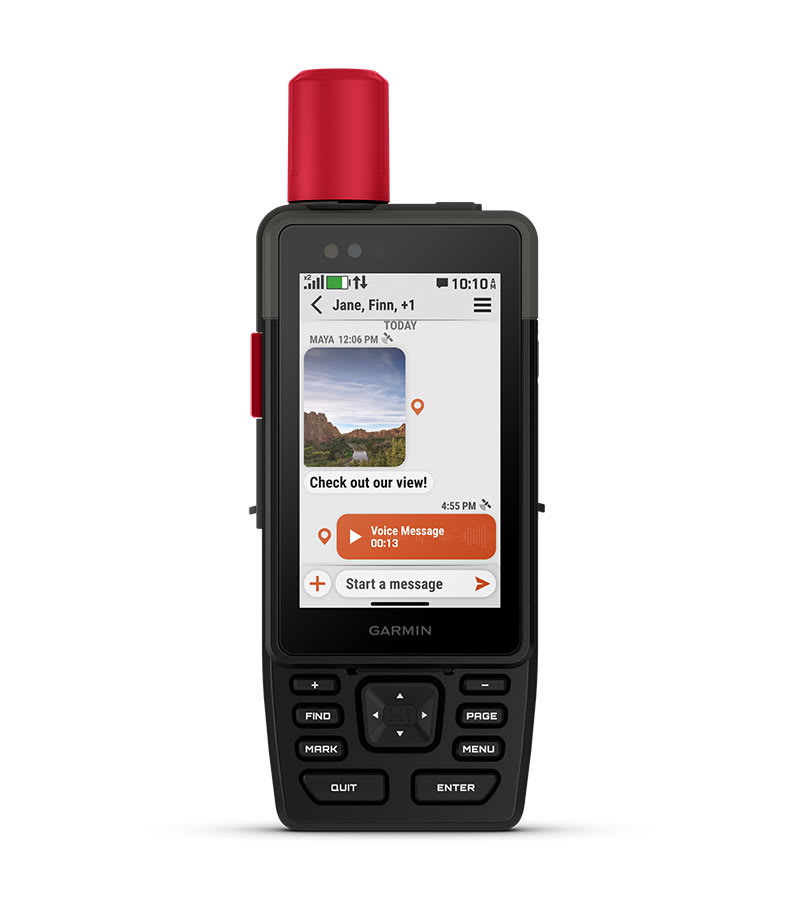
PHOTOS AND VOICE/TEXT MESSAGING
With an active inReach subscription1, send group text messages up to 1,600 characters. You can also exchange photos and voice messages when outside of cellular coverage.
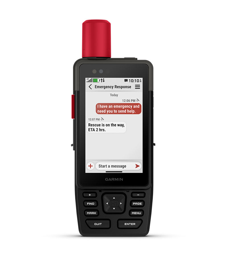
SOS ALERTS
Trigger an interactive SOS message anytime to the 24/7-staffed Garmin Response international coordination center for help in an emergency. This requires an active inReach subscription1.
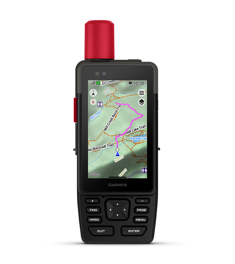
ADVANCED NAVIGATION
Navigate with preloaded TopoActive maps for the U.S., Mexico and Canada — and easy-to-access global maps. See terrain contours, elevations, geographical points and more.
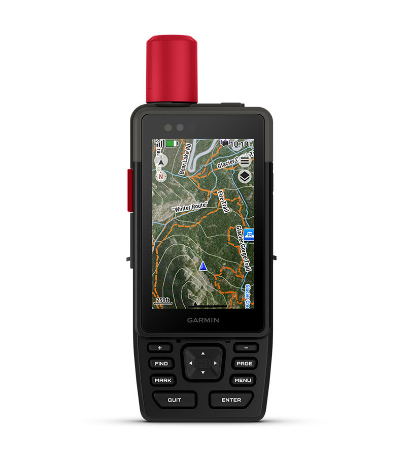
SATELLITE IMAGERY
Download high-resolution photorealistic maps directly to your device via Wi-Fi® technology. Find trails, pick stand locations and parking, create waypoints and more.
BUILT FOR ADVENTURE
KNOW THE UNKNOWN
OUTDOOR MAPS+
Purchase an Outdoor Maps+ plan for access to a variety of premium mapping content across the globe. Plans are updated regularly and sent to your device over Wi-Fi.
LOCATION ACCURACY
Get multi-band GPS and multi-GNSS support for superior positional accuracy.
BUILT-IN CAMERAS
The integrated front and back cameras allow you to snap selfies and photos of your trip. With an active inReach subscription1, share your photos in real time even without a cellular network.
VOICE CONTROL
Utilize voice commands to conveniently handle many tasks, including check-ins, start tracking, take a photo and more. Available in English, German, Italian, Spanish, French, Swedish, Danish and Dutch.
LIVETRACK™ SHARING
With an active inReach satellite subscription1 you can easily let friends or family follow your location while you're on the move; no need to point your device directly toward the sky to find satellites. They can see your progress, including distance, time and elevation.
GARMIN WEATHER
Get real-time forecast information so you're aware of the changing conditions. This feature requires an active Wi-Fi connection or an active cellular connection and use of the Garmin Explore™ app on your paired smartphone. When you travel beyond cell range, access weather updates via satellite1 for your current location, route destination and more.
PLAN YOUR TRIPS
Enjoy seamless trip planning with the ability to easily locate geographic points, share your route and more. This requires an active Wi-Fi connection or cellular connection with use of the Garmin Explore app on your compatible smartphone.
GARMIN SHARE
Easily share saved locations and courses with friends' compatible Garmin devices.
ASCENT PLANNING
See upcoming climbs on your route, when they will occur and how steep they will be.
EVOLVED DESIGN
HELPFUL TOOLS
Use the built-in bright LED flashlight torch as a beacon or to light your way when the path goes dark. A loud built-in siren can help draw attention if you are in need.
BATTERY LIFE
Long-lasting battery life allows for up to 145 hours inall Satellite Systems + Multi-band mode (assuming typical use with SatIQ™ technology) and up to 840 hours in Expedition mode.
RUGGED DESIGN
This device is built to meet MIL-STD 810 standards for thermal, shock, water (IP67) and vibration to withstand weather and extreme temperatures.
ON THE GO
This device has an integrated Spine Mount 2 and includes a removable loop carabiner for more versatility on your adventure. It's also compatible with additional Spine Mount 2 accessories, sold separately.
ABC SENSORS
Get a built-in altimeter for elevation data, a barometer to monitor weather and a 3-axis electronic compass to provide direction.
- Active satellite subscription required. Some jurisdictions regulate or prohibit the use of satellite communication devices. It is the responsibility of the user to know and follow all applicable laws in the jurisdictions where the device is intended to be used.
Maps
Maps for New Regions
Need maps for regions other than the ones that came on your device? See all maps that are compatible with your device.
Need a map update?
Update the maps that came with your device for the best navigation experience.
Check for Updates
In the Box
- GPSMAP® H1i Plus
- Loop Carabiner
- Charging/Data Cable
- Documentation
Specs
General | |
| Lens material | chemically strengthened glass |
|---|---|
| Dimension | 2.6" x 7.0" x 1.3"(6.7 cm x 17.9 cm x 3.3cm) |
| Weight | 10.2 oz (290 g) |
| Water rating | IP67 |
| MIL-STD-810 | yes (thermal, shock, water); bare unit only |
| Touchscreen | yes |
| Display Type | transflective color TFT |
| Display Size | 1.9"W x3.0"H (4.7 x 7.7 cm), 3.5" diagonal (8.9 cm) |
| Display resolution | 282 x 470 pixels |
| Battery Type | rechargeable, internal lithium-ion |
| Battery life |
All Satellite Systems + Multi-band: Up to 145 hours* *Assuming typical use with SatIQ™ technology |
| Memory/History | 64 GB (user space varies based on included mapping) |
| Interface | USB-C |
Maps & Memory | |
| Preloaded maps | yes (TopoActive, routable) |
|---|---|
| Ability to add maps | yes |
| Basemap | yes |
| Automatic routing (turn by turn routing on roads) for outdoor activities | yes |
| Map segments | yes (15,000) |
| Satellite imagery | yes (direct to device) |
| Includes detailed hydrographic features (coastlines, lake/river shorelines, wetlands and perennial and seasonal streams) | yes |
| Includes searchable points of interests (parks, campgrounds, scenic lookouts and picnic sites) | yes |
| Displays national, state and local parks, forests and wilderness areas | yes |
| External memory storage | yes (1 TB max microSD card) |
| Waypoints | yes |
| Courses | unlimited |
| Activities | unlimited |
| Activity profiles | yes |
| GPX imports | yes |
| Rinex logging | yes |
Sensors | |
| GPS | yes |
|---|---|
| Galileo | yes |
| QZSS | yes |
| BeiDou | yes |
| IRNSS | yes |
| Barometric altimeter | yes |
| Compass | yes |
| High-sensitivity receiver | yes |
| GPS compass (while moving) | yes |
| Multi-band frequency support | yes |
Daily Smart Features | |
| Connect IQ™(downloadable watch faces, data fields and apps) | yes |
|---|---|
| Smart notifications on handheld | yes |
| Weather forecasts | yes |
| Weather | yes |
| Compatible with Garmin Messenger app | yes |
| Pairs with Garmin Connect™ mobile | yes |
| Voice command | yes |
| Noise cancellation | yes |
| Voice assistant | yes |
| Voice notes | yes |
| Garmin Share | yes |
| Passcode | yes |
| Next Word, Auto Complete, Auto Correct | yes (Auto Correct, Next Word, Auto Complete) |
Safety and Tracking Features | |
| LiveTrack | yes |
|---|---|
| Safety siren | yes |
Tactical Features | |
| Compatible with AB Quantum - Garmin | yes |
|---|---|
| Ballistics solver | yes (unlock required) |
| Dual grid coordinates | yes |
| Night vision mode | yes |
Outdoor Recreation | |
| Spoken turn-by-turn directions | yes |
|---|---|
| Area calculation | yes |
| Sun and moon information | yes |
| Geocaching-friendly | yes (Geocache Live) |
| Custom maps compatible | yes (500 custom map tiles) |
| Picture viewer | yes |
| Camera | Front: 5 MP |
| Flashlight | yes |
Mapping & Navigation | |
| Point-to-point navigation | yes |
|---|---|
| TracBack® | yes |
inReach® Features | |
| Interactive SOS | yes |
|---|---|
| Weather | yes |
| Send and receive text messages to SMS and email | yes |
| Send and receive text messages to other inReach device | yes |
| Send and receive group messages | yes |
| Send and receive photos | yes |
| Send and receive voice messages | yes |
| Send and receive 1,600 character messages | yes |
| Exchange locations with other inReach device | yes |
| LiveTrack | yes |
| Virtual keyboard for custom messaging | yes |
Outdoor Applications | |
| Compatible with Garmin Explore™ app | yes |
|---|---|
| Garmin Explore website compatible | yes |
| Smart switching between Wi-Fi, Cellular and Satellite with Garmin Messenger app | yes |
| Dog tracking | yes (when paired to compatible dog track system) |
Networking & Connections | |
| Wireless Connectivity | yes (Wi-Fi®, BLE, ANT+®) |
|---|---|