

Tread® 2 - Overland Edition


Tread® 2 - Overland Edition
Overview

ROAM THE UNKNOWN ON YOUR NEXT EXPEDITION
This rugged all-terrain navigator will show you the way, with navigation that guides you through even the most remote areas less traveled.
ULTRABRIGHT, GLOVE-FRIENDLY 8-INCH DISPLAY
TURN-BY-TURN TRAIL NAVIGATION WITH TOPOGRAPHIC MAPS FOR NORTH AND SOUTH AMERICA
SEE HIGH-DEFINITION ELEVATION MAPS, LAND BOUNDARIES AND MORE
CUSTOM STREET ROUTING FOR THE SIZE AND WEIGHT OF YOUR RIG1
SATELLITE IMAGERY SHOWS VIVID OVERHEAD VIEWS OF YOUR ROUTE
SUPPORTS OUTDOOR MAPS+ FOR PREMIUM MAPPING (SUBSCRIPTION REQUIRED)
WHAT YOU'LL LOVE
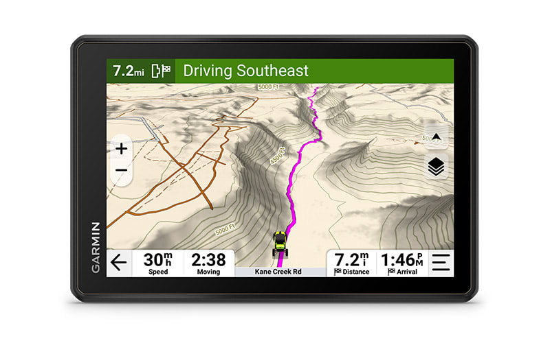
RUGGED DESIGN
The 8-inch high-resolution, ultrabright and glove-friendly touchscreen navigator is purpose-built to withstand extreme temperatures and weather (IP67 dust/water rating) for rugged off-road adventures. The heavy-duty mounting hardware withstands high vibration and shock. Plus, the upgraded processor delivers faster performance, including map drawing and route calculations.
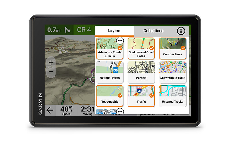
TURN-BY-TURN NAVIGATION
Get turn-by-turn trail navigation for unpaved roads and trails in off-road riding areas with OpenStreetMap™, U.S. Forest Service Motor Vehicle Use Maps, and Adventure Roads and Trails map content2. In North America, view off-road riding areas with trail difficulty ratings.
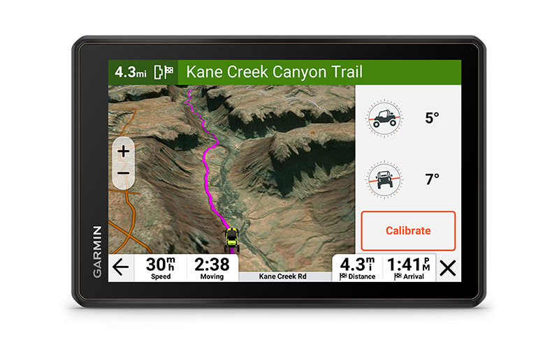
SATELLITE VIEWS
Download subscription-free satellite imagery directly to the device via Wi-Fi® technology to see high-resolution overhead views of routes and terrain.
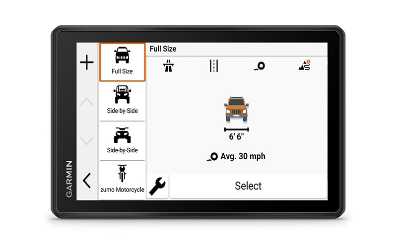
CUSTOM ROUTING
Get City Navigator® maps of North America with custom street routing for the size and weight of your rig1. Plus, receive alerts for potential hazards along your route, including sharp curves, speed changes and more.
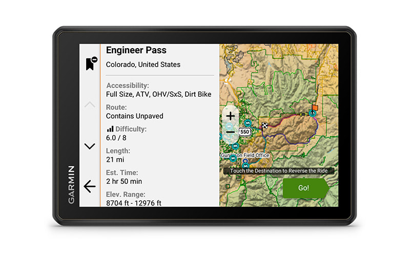
GREAT RIDES
Find great rides for off-road; discover the best places to explore, bookmark them to sync with your navigator, rate difficulty, and upload pics (requires use of the Tread® smartphone app).
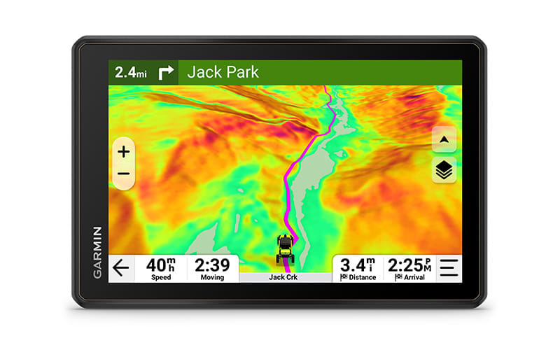
OUTDOOR MAPS+
Purchase an Outdoor Maps+ subscription for ongoing access to a wide variety of premium mapping content, including burn zones, night lights and more.
FIND NEW WAYS TO EXPLORE
NAVIGATION FEATURES
EASY ROUTE PLANNER
Use the Tread smartphone app to easily plan routes with the same maps, vehicle profiles and route preferences that you have on the Tread device. Import and export GPX files to share your favorite routes with your fellow riders.
CAMPGROUNDS
The Tread 2 navigator comes with a preloaded directory of Ultimate Public Campgrounds to help you find more than 46,000 camping locations across the U.S.
GROUP RIDE MOBILE
Track friends from your compatible smartphone or Tread device when you and your friends use the Tread app's group ride mobile feature.
SYNC YOUR DEVICES
Use the Tread mobile app to easily sync waypoints, tracks, routes and collections across your mobile device and Tread 2 navigator.
ELEVATION MAPS AND MORE
Venture on- and off-road with high-definition digital elevation maps. Explore dirt and snow trails, or follow City Navigator maps for street routes2.
ABC SENSORS
For tough-terrain guidance, built-in sensors include an altimeter, barometer and compass.
KNOW YOUR BOUNDARIES
Access public land boundaries for national forests, Bureau of Land Management, wilderness areas and more. Also, see private land boundaries and landowner information for parcels greater than 4 acres.
LIVE WEATHER
Weather ahead? Pair Tread 2 with your compatible smartphone, and download the Tread app to access live weather, storm alerts, animated radar and more.
TRAVELING MUSIC
A built-in media player lets you easily control music loaded on your compatible smartphone on the navigator's display — and hear your tunes through your helmet or headset enabled with BLUETOOTH® technology.
COMPATIBILITY FEATURES
DIGITAL SWITCH BOX
Enable on-screen control for your vehicle's 12-volt electronics — including light bars, differential locks and more — when paired with your Garmin PowerSwitch™ digital switch box. This feature is not intended for controlling motors with reverse polarity.
INREACH® TECHNOLOGY
Pair your Tread 2 – Overland Edition with your compatible inReach global satellite communicator3 for two-way text messaging, interactive SOS and weather. With select devices, you can even send photo and voice messages.
DOG TRACKING
Wirelessly pair your Tread 2 navigator with your compatible Garmin GPS dog tracker to help track and retrieve your sporting dogs in the field. You'll see markers for each dog within tracking range, overlaid right on the navigator's map screen.
GROUP RIDE RADIO
When you ride outside of cell coverage, pair Tread 2 with your Group Ride Radio for location sharing and voice communication with your group using the included push-to-talk fist mic. Pair Tread with your helmet or headset enabled with BLUETOOTH technology for hands-free communication.
MESSAGING ON THE GO
Communicate via two-way text messaging4 with other Garmin Messenger™ app users. Send and receive messages directly from your Tread 2 navigator's display.
- Not available in all areas. Entering your vehicle's profile characteristics does not guarantee your vehicle's characteristics will be accounted for in all route suggestions. Always defer to all posted road signs and road conditions.
- Limitations may exist in map data for some road and trail route suggestions. Always defer to all posted road signs and conditions during vehicle operation. Garmin products using OpenStreetMap data are intended to be used only as supplementary travel aids.
- Active satellite subscription required. Some jurisdictions regulate or prohibit the use of satellite communication devices. It is the responsibility of the user to know and follow all applicable laws in the jurisdictions where the device is intended to be used.
- Requires both the sender and receiver of messages to have the Garmin Messenger app installed on their paired smartphones
Maps
Maps for New Regions
Need maps for regions other than the ones that came on your device? See all maps that are compatible with your device.
Need a map update?
Update the maps that came with your device for the best navigation experience.
Check for Updates
In the Box
- Tread 2 - Overland Edition
- Suction cup mount
- Vehicle power cable
- Locking magnet-assisted mount
- USB cable
- Documentation
Specs
General | |
| Dimension | 8.1"W x 5.4"H x 1.1"D (20.6 x 13.7 x 2.8 cm) |
|---|---|
| Weight | 22.1 oz (627 g) |
| Water rating | IPX7 |
| Display Type | multi-touch, glass, high brightness HD color TFT with white backlight |
| Display Size | 6.8"W x 4.2"H(10.8 cm x 17.2 mm); 8" diagonal (20.3 cm) |
| Display resolution | 1280 x 800 pixels |
| Dual-orientation display | yes |
| Magnetic Mount | locking magnet-assisted mount |
| 1.5-inch ball adapter with AMPS plate | yes |
| Drop rating | MIL-STD-810 |
| Dust rating | IP6X |
| Battery Type | rechargeable lithium-ion |
| Battery life | Up to 6 hours at 50% backlight |
Maps & Memory | |
| Data cards | microSD™ card (not included) |
|---|---|
| Preloaded street maps | yes |
| High-definition 3D terrain | yes |
| 3D Terrain | yes |
| Internal storage | 64 GB |
| Ability to add maps | yes |
| External memory storage | yes (256 GB max microSD™ card) |
| Includes map updates | yes |
| Downloadable Satellite Imagery | yes |
| TOPO map support | yes |
Sensors | |
| GPS | yes |
|---|---|
| Galileo | yes |
| Barometric altimeter | yes |
| Compass | yes |
| 10 Hz multi-GNSS positioning | yes |
Outdoor Recreation | |
| Preloaded topographical maps | yes |
|---|---|
| Preloaded US public land boundaries | yes |
| Preloaded private land parcel maps | yes (parcels greater than 4 acres) |
| Preloaded USFS Roads and Trails, including motor-vehicle-use-maps for motorcycle, ATV, SXS and full-size 4x4 | yes |
| Navigate-a-track navigation | yes |
| Turn-by-turn trail navigation | yes |
| Compatible with Outdoor Maps+ subscription | yes |
Mapping & Navigation | |
| Point-to-point navigation | yes |
|---|---|
Camera Features | |
| Backup camera compatible | yes (BC™ 50 only) |
|---|---|
Navigation Features | |
| Garmin Real Directions™ landmark guidance | yes |
|---|---|
| TripAdvisor® traveler ratings | yes |
| Route shaping through preferred cities/streets | yes |
| Includes traffic | yes (with Garmin Tread app) |
| Lane assist with junction view (displays junction signs) | yes |
| Bluetooth® pairing | yes (works with BLUETOOTH-compatible helmet, headset or smartphone; BLE capable) |
| Speed limit indicator (displays speed limit for most major roads in the U.S. and Europe) | yes |
Advanced Features | |
| Smart notifications via app | yes |
|---|---|
| Wi-Fi® map and software updates | yes |
| Access to live services via app (traffic, weather, etc.) | yes |
Motorcycle Features | |
| Control music and media from smartphone or MP3 player | yes |
|---|---|
| Sunlight readable and weather resistant | yes |
| Garmin Adventurous Routing™ | yes |
| Elevation profile | yes |
| Round trip routing | yes |
| Custom map support | yes |
RV Features | |
| Specialized routing for the size and weight of your vehicle | yes |
|---|---|
| RV Parks & Services directory | yes |
| Road elevations | yes |
| Speed limit changes | yes |
| Easy Route Planner with GPX file sharing | yes |
Adventure Features | |
| Pair with Garmin PowerSwitch™ digital switch box | yes |
|---|---|
| Compatible with handlebar controller | yes |
| Compatible with Group Ride Radio | yes |
| Compatible with external GPS antenna with mount | yes |
| Group Ride Mobile | yes (with Garmin Tread app) |
| Track recorder (breadcrumbs) | yes |
| Compatible with the Garmin Tread app for route planning and data management (waypoints, tracks, and routes) | yes |
| Ultimate Public Campgrounds | yes |
| Pitch and Roll gauges | yes |
| Glove-friendly touchscreen | yes |
Outdoor Applications | |
| Dog tracking | yes (when paired to compatible dog track system) |
|---|---|