

Montana® 710


Montana® 710
Overview
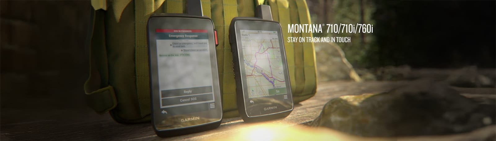
STAY ON TRACK THROUGH ALL KINDS OF ADVENTURES
With routable mapping for roads and trails, the Montana 710 handheld brings advanced outdoor features into a sturdy 5-inch format that's ideal for navigation on foot, bike, kayak, ATV and more.
LARGE 5-INCH GLOVE-FRIENDLY TOUCHSCREEN
PRELOADED TOPOGRAPHIC MAPS WITH LANDMARKS
MEETS MIL-STD 810 FOR THERMAL, SHOCK, WATER AND VIBRATION
SATELLITE IMAGERY SHOWS VIVID OVERHEAD VIEWS OF YOUR ROUTE
SUPPORTS OUTDOOR MAPS+ FOR PREMIUM MAPPING (SOLD SEPARATELY)
PLAN AND REVIEW TRIPS WITH THE GARMIN EXPLORE™ SMARTPHONE APP
WHAT YOU'LL LOVE
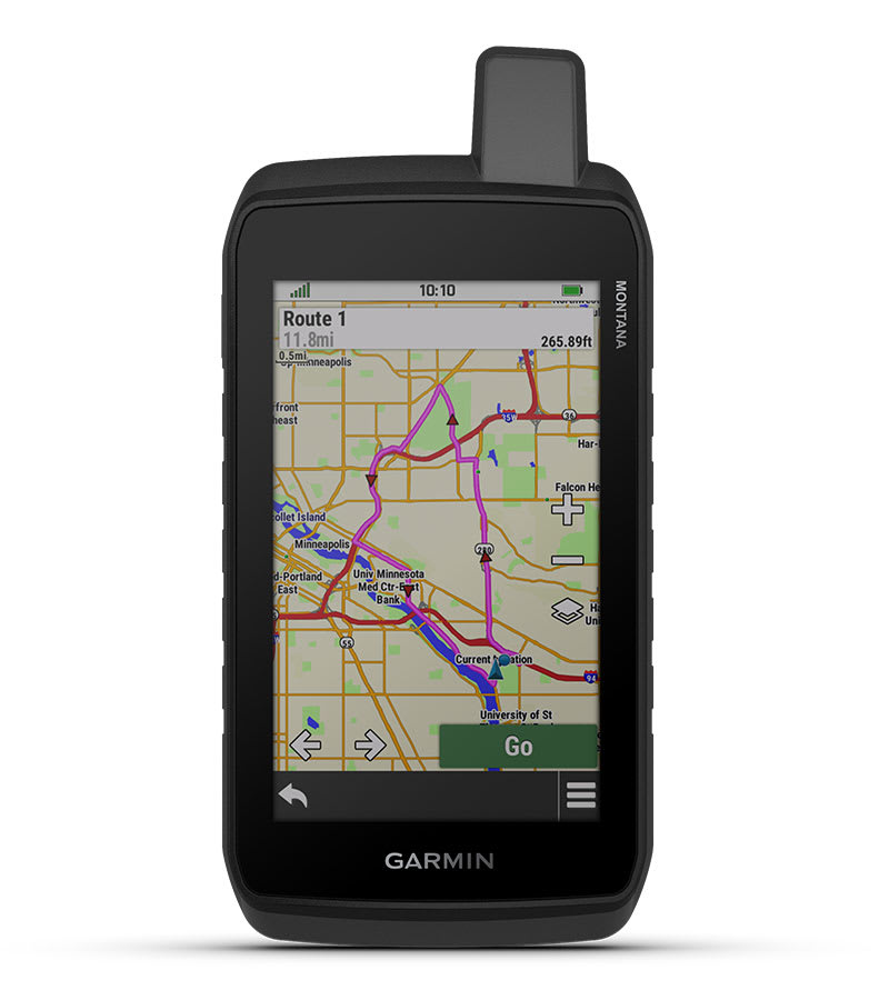
RUGGED BY DESIGN
This durable, water-resistant handheld is tested to meet MIL-STD 810 for thermal, shock, water and vibration. It features a glove-friendly 5-inch touchscreen and is compatible with a variety of robust mounting solutions (sold separately) to best suit your activities.
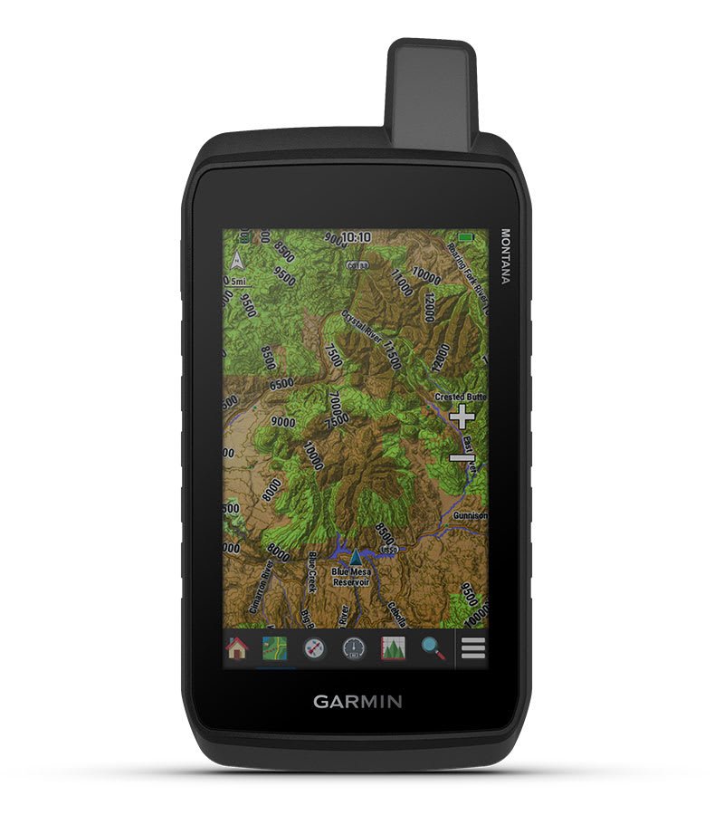
TOPOACTIVE MAPS
To navigate your adventures, use preloaded worldwide topographical maps. View terrain contours, elevations, coastlines, rivers, landmarks and more.
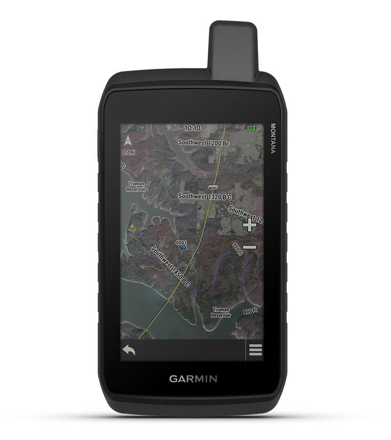
SATELLITE VIEWS
Access subscription-free, high-resolution satellite imagery with direct-to-device downloads over Wi-Fi® connectivity. See photorealistic overhead views of routes and surrounding terrain, and easily create waypoints based on landmarks.
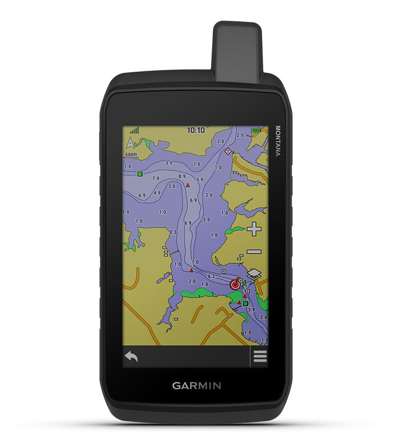
ADDITIONAL MAPS
With 32 GB of onboard memory, you can download even more maps, such as City Navigator® maps for your drive or BlueChart® g3 charts for the water (sold separately).
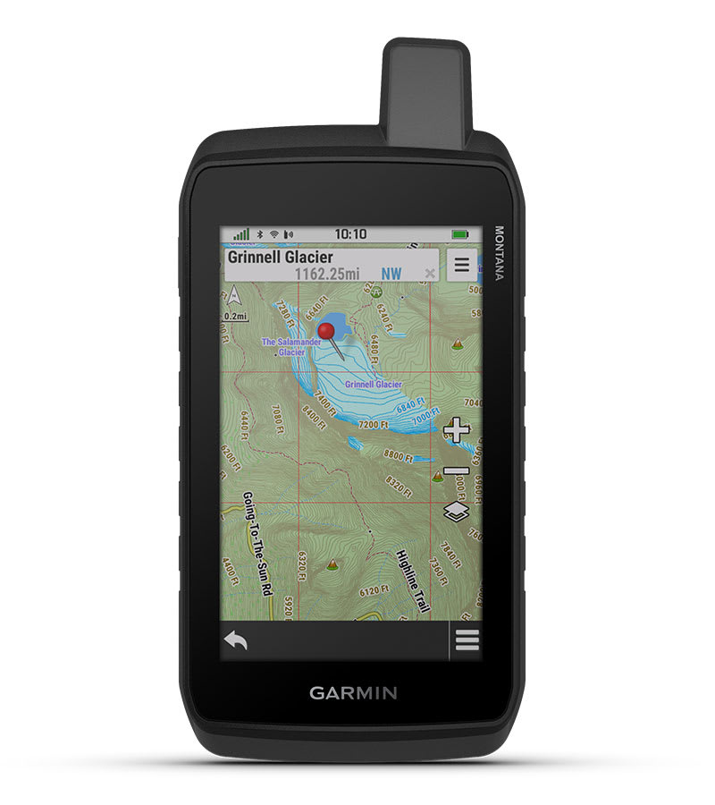
OUTDOOR MAPS+
With a subscription to Outdoor Maps+ (sold separately), get ongoing access to a wide variety of premium mapping content and regular updates sent right to your Garmin device via Wi-Fi technology.
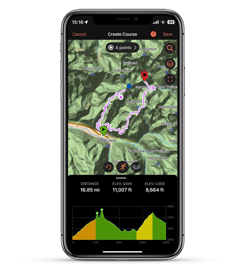
GARMIN EXPLORE APP
Pair with the Garmin Explore app to plan and review trip data, plus manage your waypoints, courses and activities.
TRACK YOUR ADVENTURES ON ANY TERRAIN
NAVIGATION FEATURES
MULTI-GNSS SUPPORT
Access to GPS and Galileo satellite networks enables Montana 710 to track in more challenging environments than GPS alone.
ABC SENSORS
Navigate your next trail with ABC sensors, including an altimeter for elevation data, barometer to monitor weather and 3-axis electronic compass.
ACTIVE WEATHER
Access up-to-date active weather forecasts via the Garmin Connect™ app on your compatible smartphone.
DOG TRACKING
For hunters and trainers, this Montana handheld syncs with your compatible Astro® or Alpha® series handhelds to help track sporting dogs in the field.
WIKILOC TRAILS
This preloaded app lets you easily download hiking, cycling and other Wikiloc trails shared by outdoor enthusiasts like you. Get a free 60-day Wikiloc Premium trial to try this and other exclusive features. Learn more.
ADVENTURE FEATURES
EXPEDITION MODE
Trek far and wide off-grid. Use expedition mode, an ultralow-powered GPS reference, to keep Montana tracking for more than 2 weeks between recharges.
BATTERY OPTIONS
A rechargeable lithium-ion battery pack provides up to 24 hours of battery life in GPS mode and charges with a standard USB-C® cable. It can also be powered with traditional AA batteries (not included).
VEHICLE MOUNTS
A variety of Montana handheld-compatible mounts (sold separately) lets you adapt your navigator for use on ATVs, boats, cars, motorcycles, RVs or other vehicles.
Maps
Maps for New Regions
Need maps for regions other than the ones that came on your device? See all maps that are compatible with your device.
Need a map update?
Update the maps that came with your device for the best navigation experience.
Check for Updates
In the Box
- Montana 710
- High capacity lithium-ion battery pack
- USB cable
- Documentation
Specs
General | |
| Lens material | chemically strengthened glass |
|---|---|
| Dimension | 3.4" x 7.2" x 1.3" (8.76 x 18.30 x 3.27 cm) |
| Weight | 14.5 oz (410 g) with included lithium-ion battery pack |
| Water rating | IPX7 |
| MIL-STD-810 | yes (thermal, shock, water, vibe) |
| Touchscreen | yes |
| Display Type | WVGA transflective, dual orientation |
| Display Size | 2.55"W x 4.25"H (6.48 x 10.80 cm); 5" diag (12.70 cm) |
| Display resolution | 480 x 800 pixels |
| Battery Type | rechargeable lithium-ion (included) or 3 AA batteries (not included); Lithium recommended |
| Battery life |
GPS Mode: up to 24 hours Note – Battery life estimates are with full sky view and can be significantly impacted by obstructions or tree cover. |
| Memory/History | 32 GB(user space varies based on included mapping) |
| Interface | USB-C |
Maps & Memory | |
| Preloaded maps | yes (TopoActive, by region; North America) |
|---|---|
| Ability to add maps | yes |
| Basemap | yes |
| Automatic routing (turn by turn routing on roads) for outdoor activities | yes |
| Map segments | 15,000 |
| Satellite imagery | yes (direct to device) |
| Includes detailed hydrographic features (coastlines, lake/river shorelines, wetlands and perennial and seasonal streams) | yes |
| Includes searchable points of interests (parks, campgrounds, scenic lookouts and picnic sites) | yes |
| Displays national, state and local parks, forests and wilderness areas | yes |
| External memory storage | yes (32 GB max microSD™ card) |
| Waypoints/favorites/locations | 10,000 |
| Courses | 250, 200 course points per course |
| Tracks | 250 |
| Navigation Track Log | 20,000 points, 250 saved gpx tracks, 300 saved fit activities |
| Navigation Routes | 250, 250 points per route; 50 points auto routing |
| Rinex logging | yes |
Sensors | |
| GPS | yes |
|---|---|
| GLONASS | yes |
| Galileo | yes |
| Barometric altimeter | yes |
| Compass | Yes (tilt-compensated 3-axis) |
| High-sensitivity receiver | yes |
| GPS compass (while moving) | yes |
Daily Smart Features | |
| Connect IQ™(downloadable watch faces, data fields and apps) | yes |
|---|---|
| Smart notifications on handheld | yes |
| Weather forecasts | yes |
| Weather | yes |
| VIRB® Remote | yes |
| Pairs with Garmin Connect™ mobile | yes |
Safety and Tracking Features | |
| LiveTrack | yes |
|---|---|
Tactical Features | |
| XERO™ Locations | yes |
|---|---|
Outdoor Recreation | |
| Area calculation | yes |
|---|---|
| Fish forecast | yes |
| Sun and moon information | yes |
| Geocaching-friendly | yes (Geocache Live) |
| Custom maps compatible | yes (500 custom map tiles) |
| Picture viewer | yes |
| LED beacon flashlight | yes |
Mapping & Navigation | |
| Point-to-point navigation | yes |
|---|---|
| TracBack® | yes |
inReach® Features | |
| inReach remote compatible | yes |
|---|---|
Outdoor Applications | |
| Compatible with Garmin Explore™ app | yes |
|---|---|
| Garmin Explore website compatible | yes |
| Dog tracking | yes (when paired to compatible dog track system) |
Networking & Connections | |
| Wireless Connectivity | Wi-Fi®, BLUETOOTH® |
|---|---|